
The Secret to Selling Saskatoon Acreages: Why Drone Photography is a Must
![[HERO] The Secret to Selling Saskatoon Acreages: Why Drone Photography is a Must](https://cdn.marblism.com/CDLf07pue8I.webp)
Trying to sell an acreage with just ground-level photos is like asking buyers to complete a puzzle with half the pieces missing. They can see the house. They can see the garage. But what they can't see is how it all fits together: and that's the difference between an inquiry and an offer.
If you're listing acreages in Saskatoon or Central Saskatchewan, you need to understand this: buyers aren't just purchasing a home. They're purchasing land, space, privacy, and context. And you can't show that from the front porch.
📐 The Acreage Problem That Ground Photos Can't Solve
Here's what happens when you rely solely on traditional real estate photography for acreage listings:
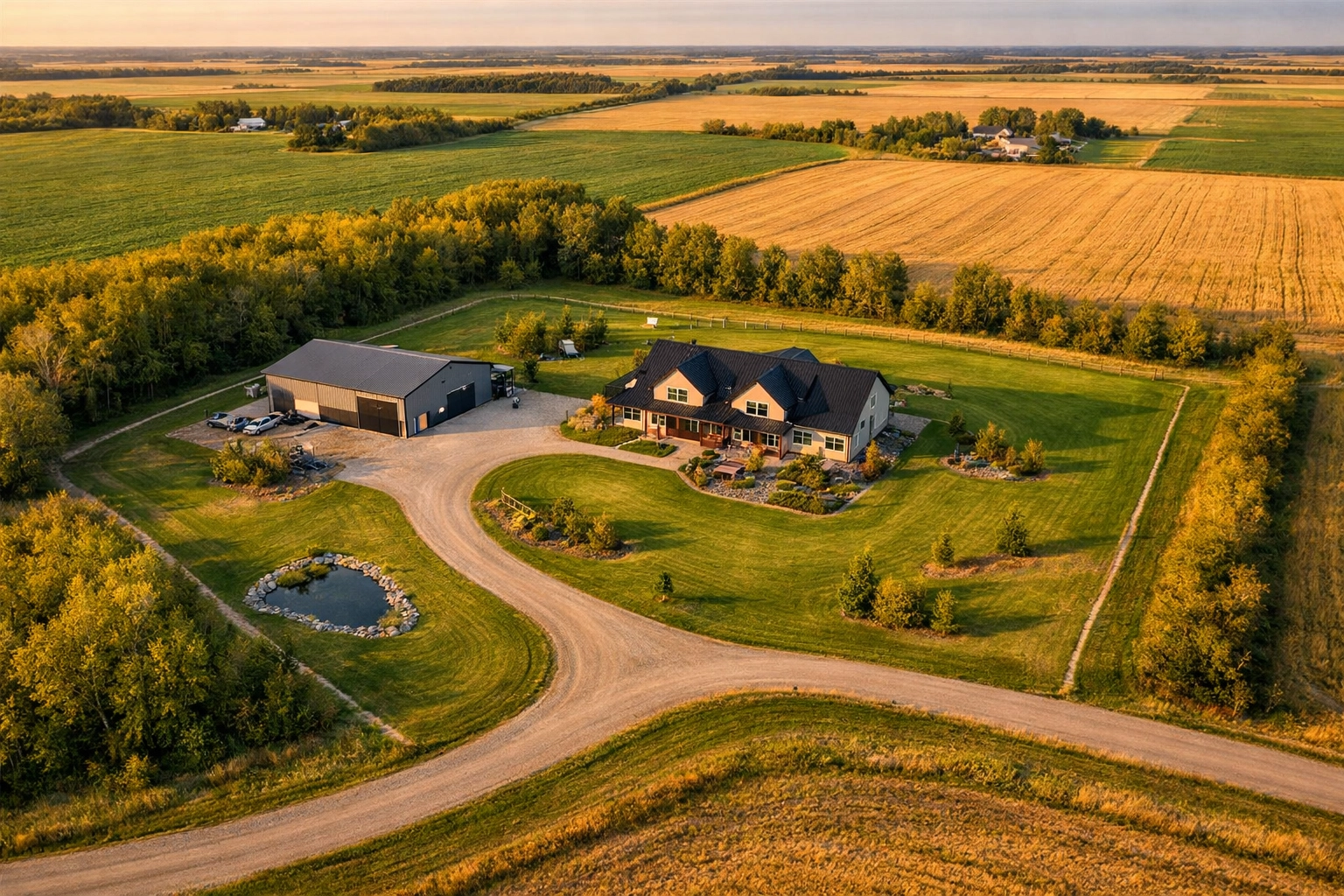
Buyers underestimate the property size. You write "5 acres" in the listing description, but without aerial perspective, it looks like a standard suburban lot with extra grass. The value doesn't translate.
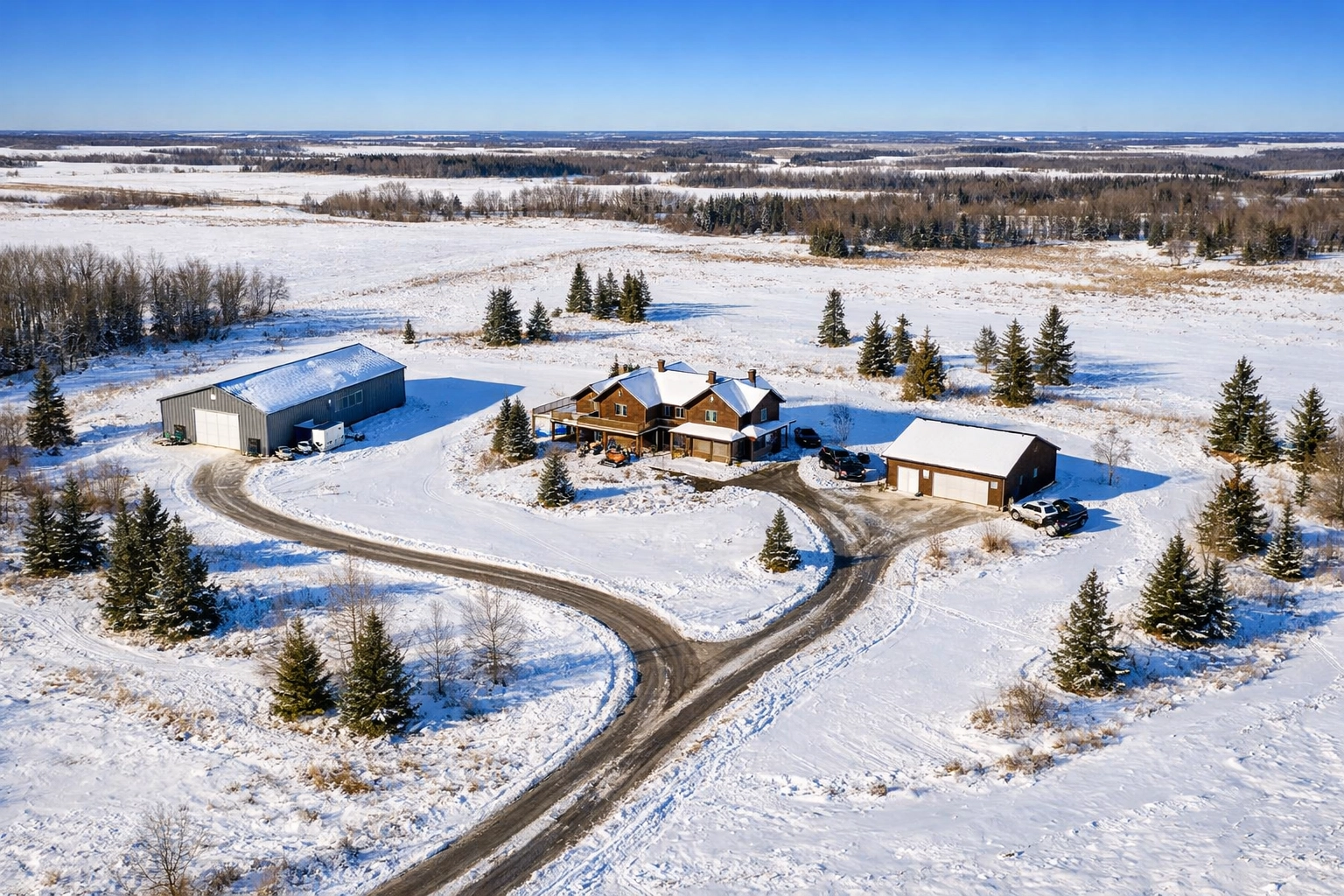
Outbuildings get lost. That 40x60 shop, the detached garage, the greenhouse: they're scattered across the property in separate photos. Buyers can't visualize where anything actually sits or how they'd use the space.
Property lines are a mystery. Where does this acreage actually end? Is that treeline on my land? How close are the neighbors? Ground-level shots can't answer these questions.
The "why" of the price doesn't land. When buyers can't see the full scope of what they're getting, your asking price feels arbitrary: even when it's completely justified.
🚁 Why Context Is Everything for Acreage Listings
Drone photography doesn't just show your listing. It tells the story.
When a potential buyer scrolls through your listing photos and hits that first aerial shot, something clicks. Suddenly, they're not looking at random pictures of a house and some buildings: they're seeing a property. A complete package. A lifestyle.
Here's what drone real estate photography Saskatoon reveals that ground shots simply can't:
The Full Layout at a Glance
One aerial image can show buyers how the main house, shop, garage, approach, and landscaping all relate to each other. They can see the natural flow of the property. They can imagine where they'd park the RV, where the kids would play, where they'd plant the garden.
It's not guesswork anymore. It's visual clarity.
Actual Property Boundaries
We can overlay property lines directly onto the aerial imagery. This is huge for acreage buyers who need to understand exactly what they're purchasing. When they see those digital boundary lines, there's no confusion about where your 5 acres starts and the neighbor's quarter-section ends.
This feature alone answers about 80% of the "land size" questions that would otherwise flood your inbox.
Distance and Privacy
How far is the nearest neighbor? How much buffer do you have from the road? Is the house tucked back in the trees or positioned for maximum sun exposure?
Aerial shots answer all of this instantly. For buyers shopping acreages specifically for privacy and space, this context is non-negotiable.
Topography and Land Features
Hills, sloughs, tree lines, cleared areas, approach conditions: drone photography captures the terrain in a way that makes sense. Buyers shopping for horse properties need to see pasture quality. Hobby farmers want to assess workable land. Hunters want to know about natural cover.
One aerial perspective does the work of a thousand words in your listing description.
📊 The Numbers: Why Drone Photography Moves Acreages Faster
Let's talk ROI, because this isn't just about pretty pictures: it's about results.
Listings with drone photography sell 68% faster. That's not a typo. When buyers can see the full property layout, they make decisions faster. The "maybe" listings become "let's book a showing" listings.
57% of homebuyers now expect aerial shots. According to the National Association of Realtors, buyers aren't just hoping for drone images: they're actively looking for them. Listings without aerials are starting to feel incomplete.
For acreages specifically, those expectations are even higher. Your buyers are sophisticated. They're comparing multiple properties. They're making six-figure decisions. If your competitor's listing has aerial shots and yours doesn't, guess which property they're calling about first?
🛡️ Transport Canada Licensed & Insured: Why This Matters
Here's something most people don't realize: not everyone with a drone can legally shoot real estate photography.
Transport Canada requires commercial drone operators to hold an Advanced Pilot Certificate and operate under strict safety and airspace regulations. At Scott Prokop Photography, we're fully licensed, insured, and compliant with all federal aviation regulations.
What does this mean for you?
- Zero liability risk. If something goes wrong (it won't, but still), you're protected.
- Legal compliance. You're not unknowingly breaking aviation laws by hiring an unlicensed operator.
- Professional operation. We know how to navigate restricted airspace, plan safe flight paths, and capture the shots that actually sell properties: not just flashy angles that look cool but don't serve your listing.
We've been flying drones for real estate in Saskatoon and Central Saskatchewan for years. We know which angles work. We know how to frame acreages to maximize their appeal. And we know how to deliver the imagery that gets buyers off the couch and into showings.
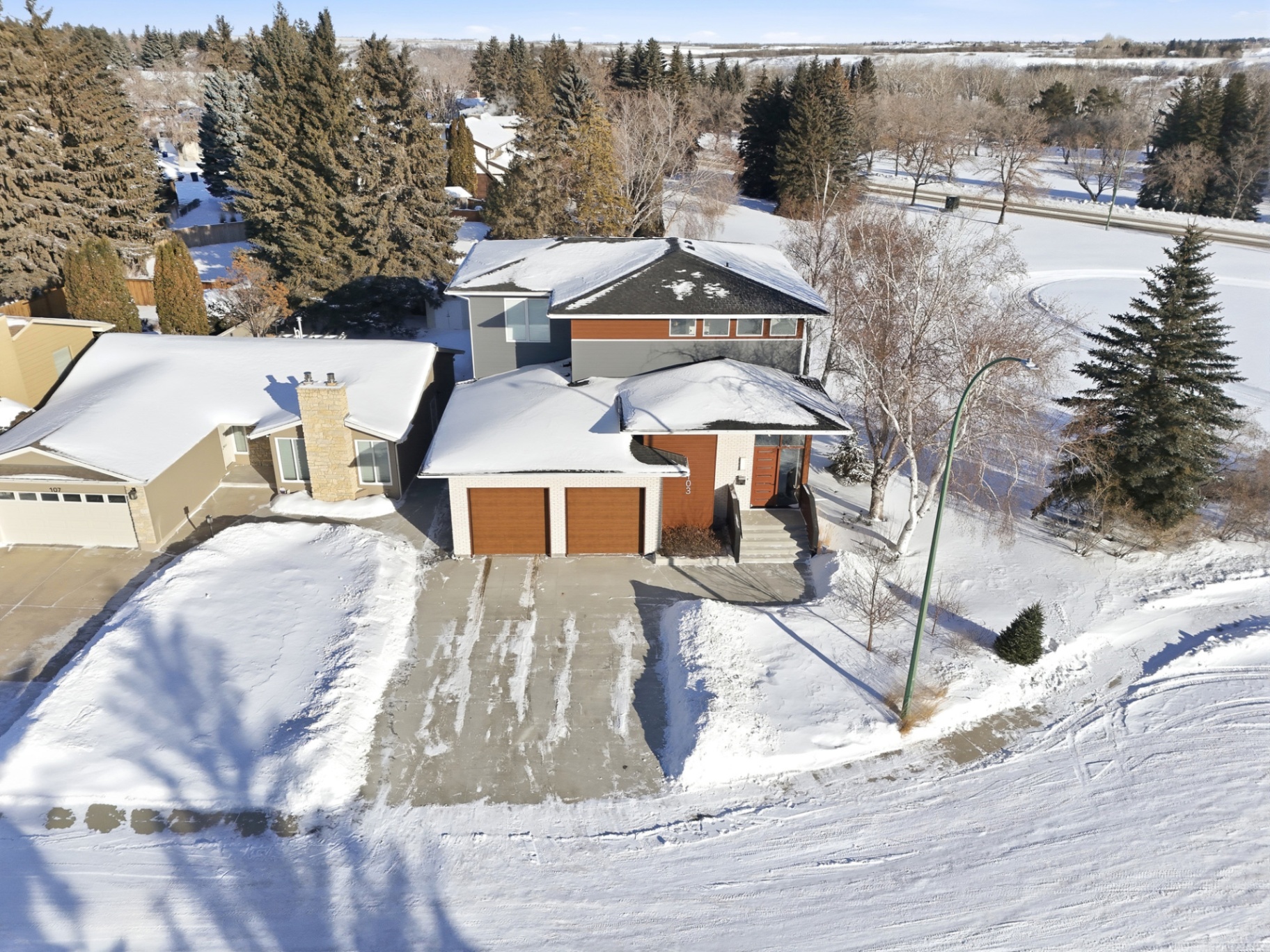
🏡 What Makes a Great Acreage Drone Shot
Not all aerial photography is created equal. Here's what separates a pro-level acreage shoot from someone just flying a drone around:
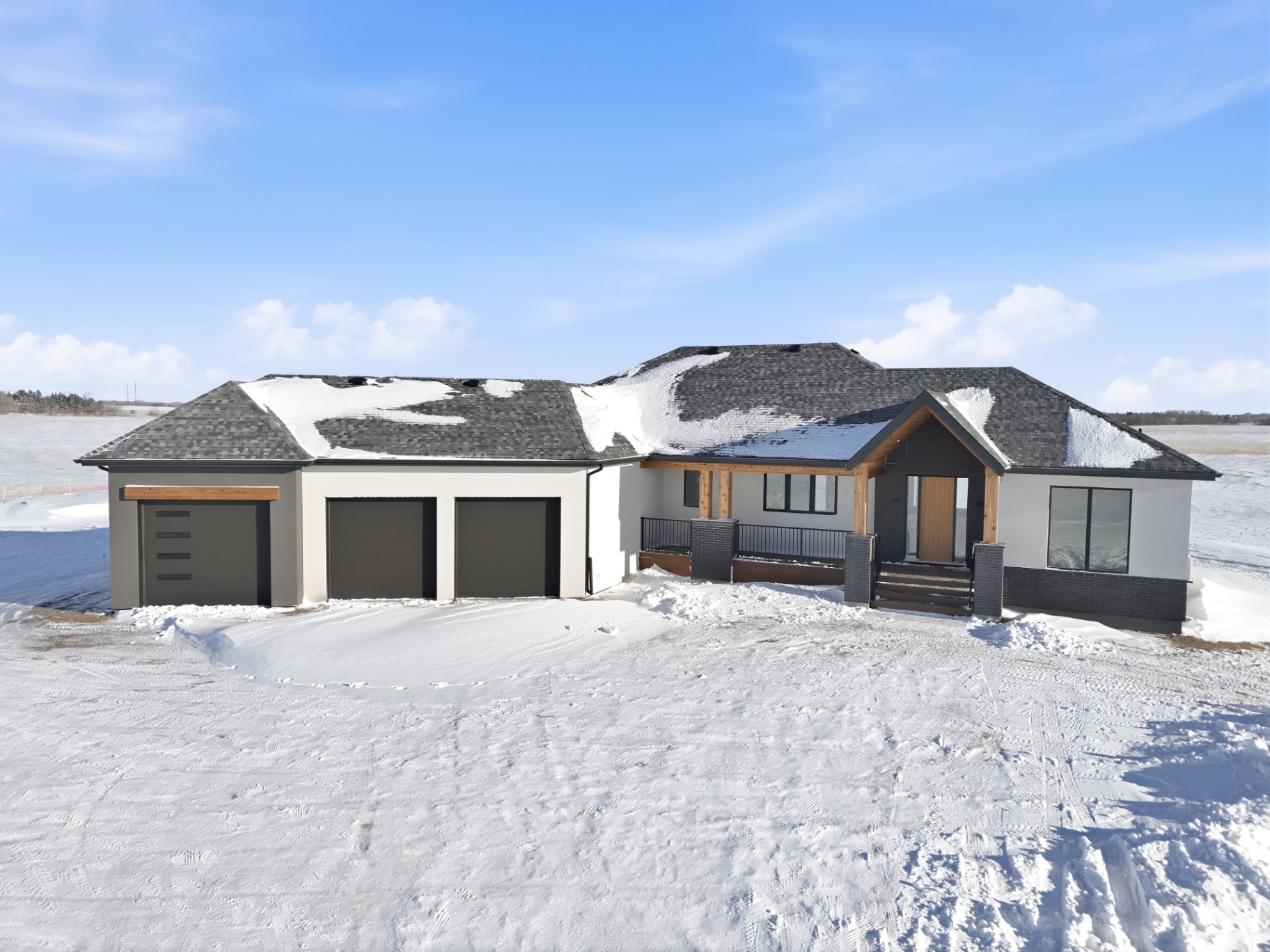
Property-focused composition. The house should be positioned to show the full lot layout: not dead-center like a bullseye. We frame shots to include context: approaches, outbuildings, land features, and surroundings.
Multiple angles and elevations. One aerial shot is good. Three to five is better. We capture different perspectives to give buyers a complete understanding of the property.
Optimal lighting. Early morning or late afternoon light makes properties pop. Harsh midday sun? Not so much. We schedule shoots to maximize natural light and visual appeal.
Clean, professional editing. Colors are balanced. Horizons are straight. Distractions are minimized. Your listing photos should look like they belong in a magazine: because they do.
🎯 Beyond the Listing: Where Drone Photos Work Overtime
Here's the bonus: drone photography doesn't just enhance your MLS listing. It supercharges every piece of marketing you do.
Social media. Aerial shots grab attention in feeds. They stop the scroll. A well-framed acreage aerial will outperform a kitchen photo every single time on Instagram or Facebook.
Property websites. If you're building a dedicated landing page for a high-end acreage, aerial hero images set the tone immediately. They say "premium listing" before a single word is read.
Email campaigns. When you're reaching out to your buyer database about a new acreage listing, lead with an aerial shot. It's visual proof that this property is worth their time.
Print marketing. Feature sheets, brochures, farm signage: aerial images translate beautifully to print and create instant credibility.
One drone shoot gives you marketing assets that work across every channel you use. That's efficiency.
✅ Ready to Show Buyers the Whole Picture?
If you're listing acreages in Saskatoon or Central Saskatchewan, you owe it to your clients: and yourself: to include professional drone photography. It's not a luxury. It's not a nice-to-have.
It's the difference between showing a property and selling one.
At Scott Prokop Photography, we specialize in real estate photographer Saskatoon services that help your listings stand out and sell faster. We're Transport Canada licensed, locally based, and we understand exactly what acreage buyers are looking for.
➡️ Ready to give your next acreage listing the aerial advantage? Let's talk about your upcoming shoots.
Scott Prokop is a licensed real estate photographer serving Saskatoon and Central Saskatchewan, specializing in drone photography, twilight shoots, and professional listing media with 24-hour turnaround.