
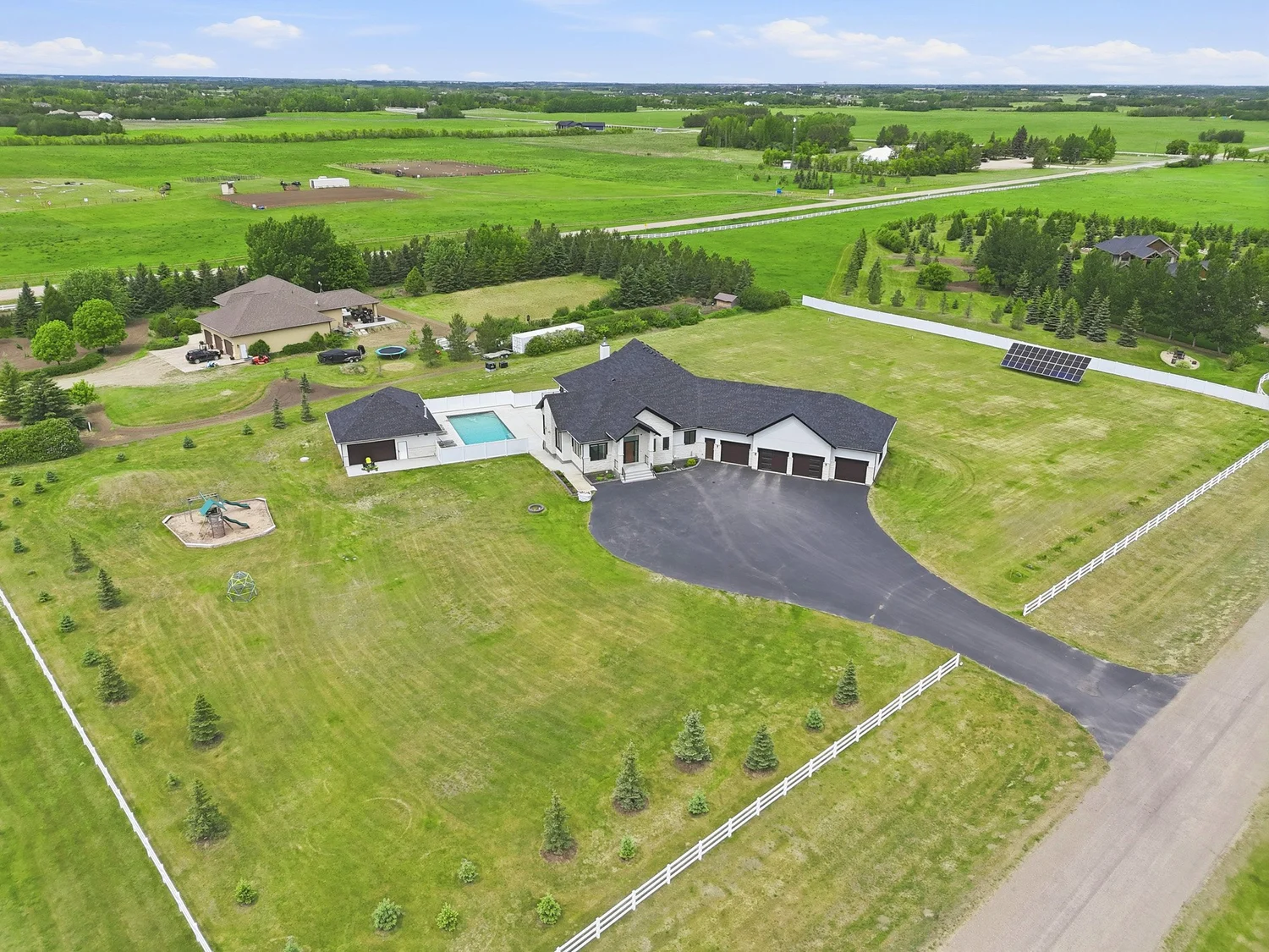
Show the property in context.
Ground photography explains the home at eye level. Drone photography and aerial video can reveal the lot, roofline, access, outdoor features and surrounding setting in one clear view.
Help buyers understand what surrounds the home.
An elevated view should add information—not simply create a dramatic angle. Aerial media is most valuable when buyers need to understand how the property relates to its land and surroundings.
- Lot shape, scale and usable space
- Driveways and access points
- Rooflines and building relationships
- Pools, patios and landscaping
- Acreage land and outbuildings
- Views and open space
- Relevant nearby landmarks
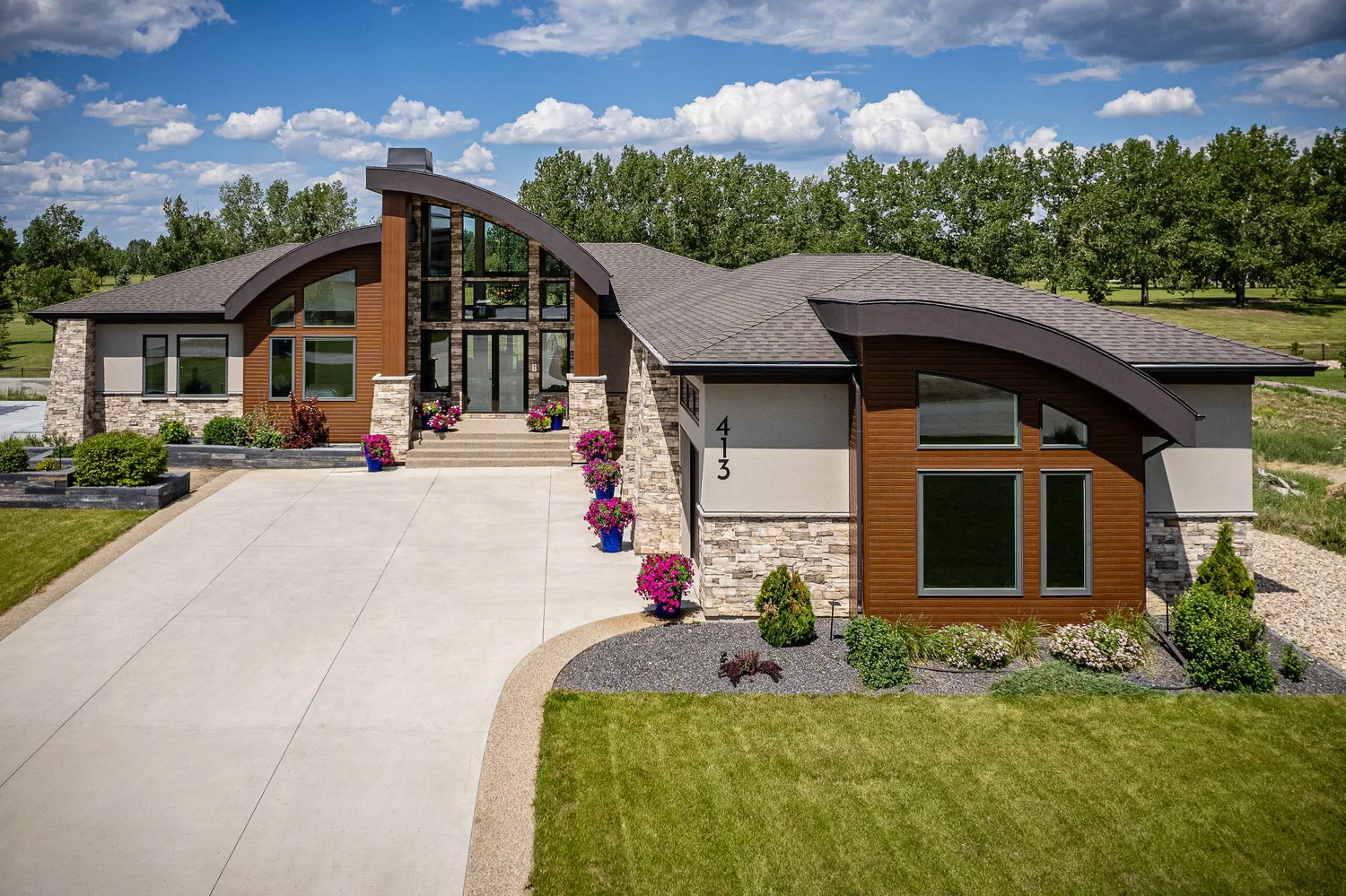
Drone photography
Edited aerial photographs create flexible assets for MLS use, property websites, feature sheets and social marketing. The viewpoint is chosen around what the listing needs to explain.
- Lower views that keep the home prominent
- Higher views for land and surrounding context
- Front, rear and angled perspectives
- Outbuildings, access and outdoor features
The result is a coherent set—not an unnecessary volume of repetitive files.
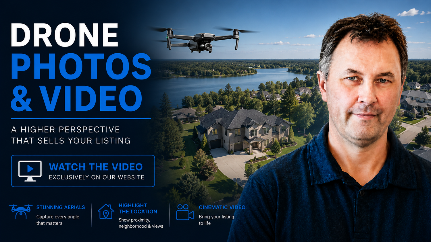 ▶
▶Drone video
Aerial video adds continuous movement across the property, access routes, outdoor features and surrounding landscape.
- Horizontal: establish setting and support a fuller property film
- Vertical: create a concise, mobile-first establishing view when the shot reads clearly
Footage is planned for the approved destination and captured only when conditions allow.
Use aerial media when it reveals something meaningful.
Drone media is not required for every listing. A straightforward urban home on a typical lot may already be explained clearly with professional exterior photography.
When the lot is part of the story
- Large or unusually shaped lots
- Homes beside parks, water or open space
- Significant landscaping or outdoor living areas
- Roofline, access or building relationships
When scale and access matter
- Acreages and rural properties
- Development land
- New communities
- Fields, outbuildings and approaches
When one view clarifies the site
- Builder projects and show homes
- Commercial sites
- Parking and multiple structures
- Construction progress and context
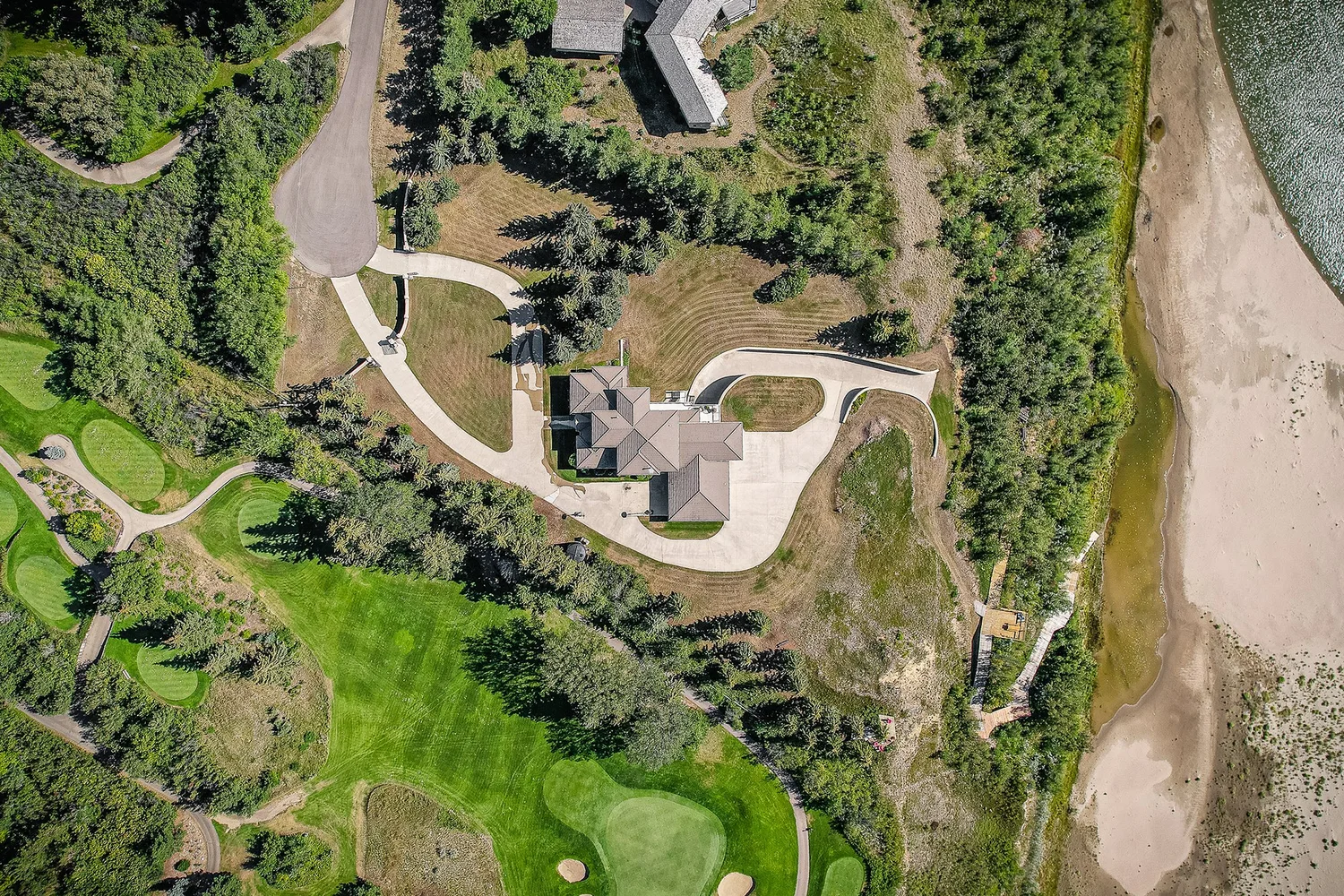
Acreages benefit from the wider story.
Acreages
Connect the residence to fields, tree lines, outbuildings, approaches and neighbouring landscape—without implying exact legal boundaries.
Developments
Show road patterns, construction progress, nearby amenities and the relationship between individual sites and the larger community.
Large residential lots
Keep the home visually important while explaining pools, patios, detached buildings, driveways and usable yard space.
Property lines, pins and neighbourhood orientation.
Restrained overlays can answer a buyer question without covering the photography or making the image harder to understand.
- Approximate property-line overlays
- Location pins or markers
- Approved points of interest
- Directional and access annotations
- Neighbourhood-context callouts
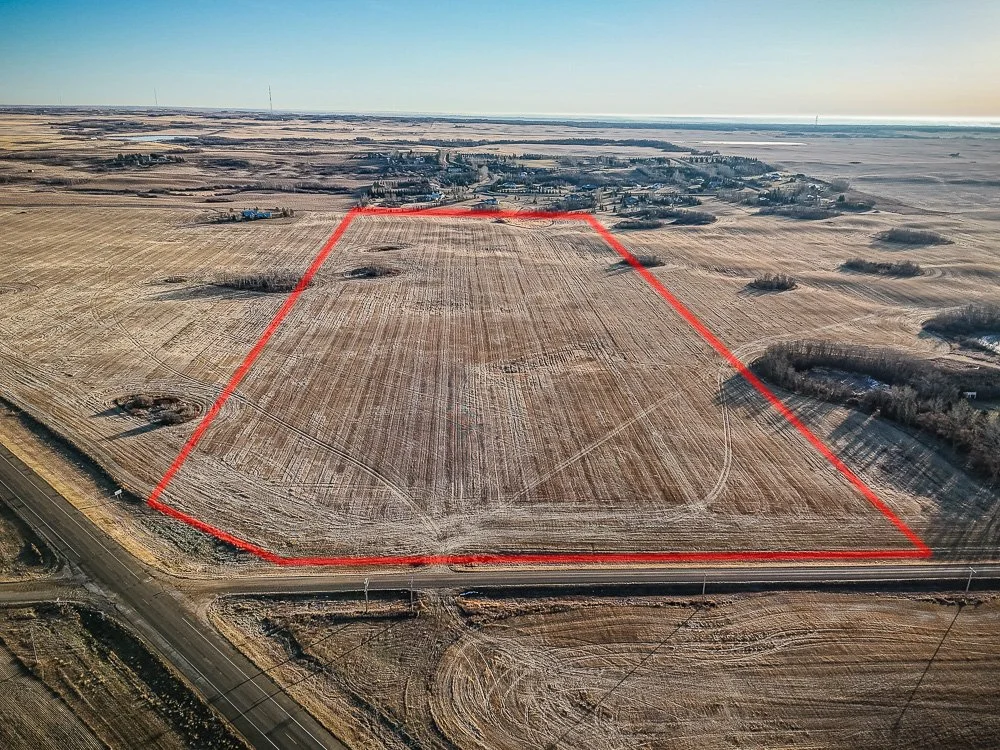
Context at three different scales.
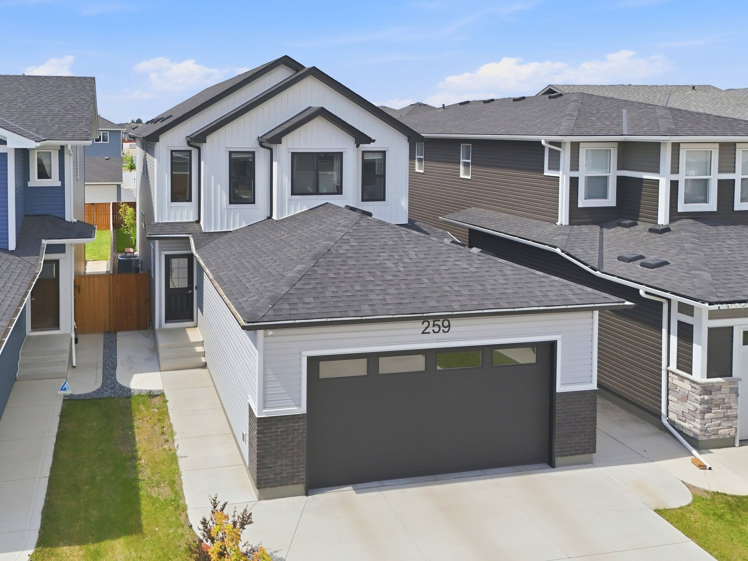
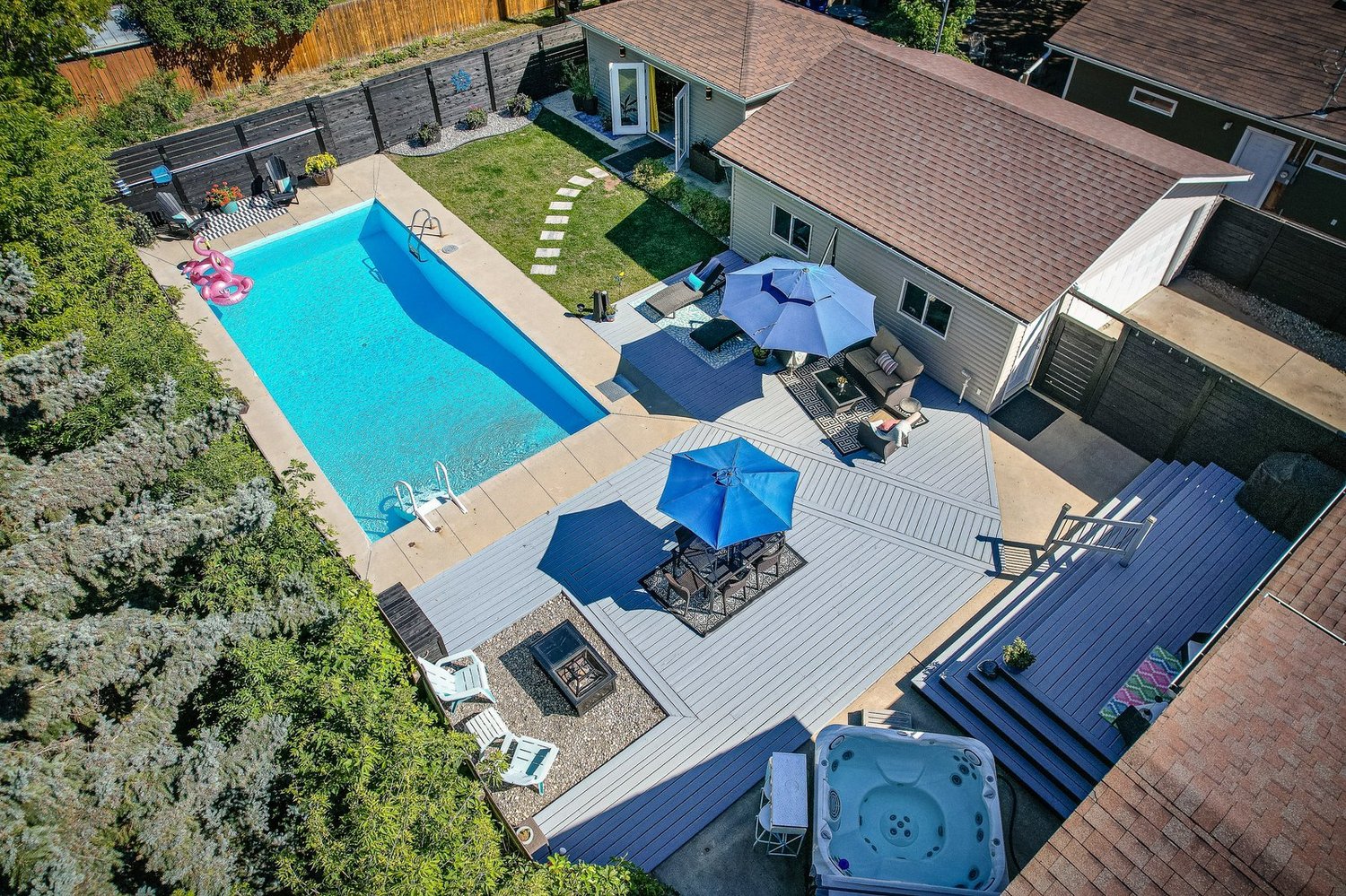
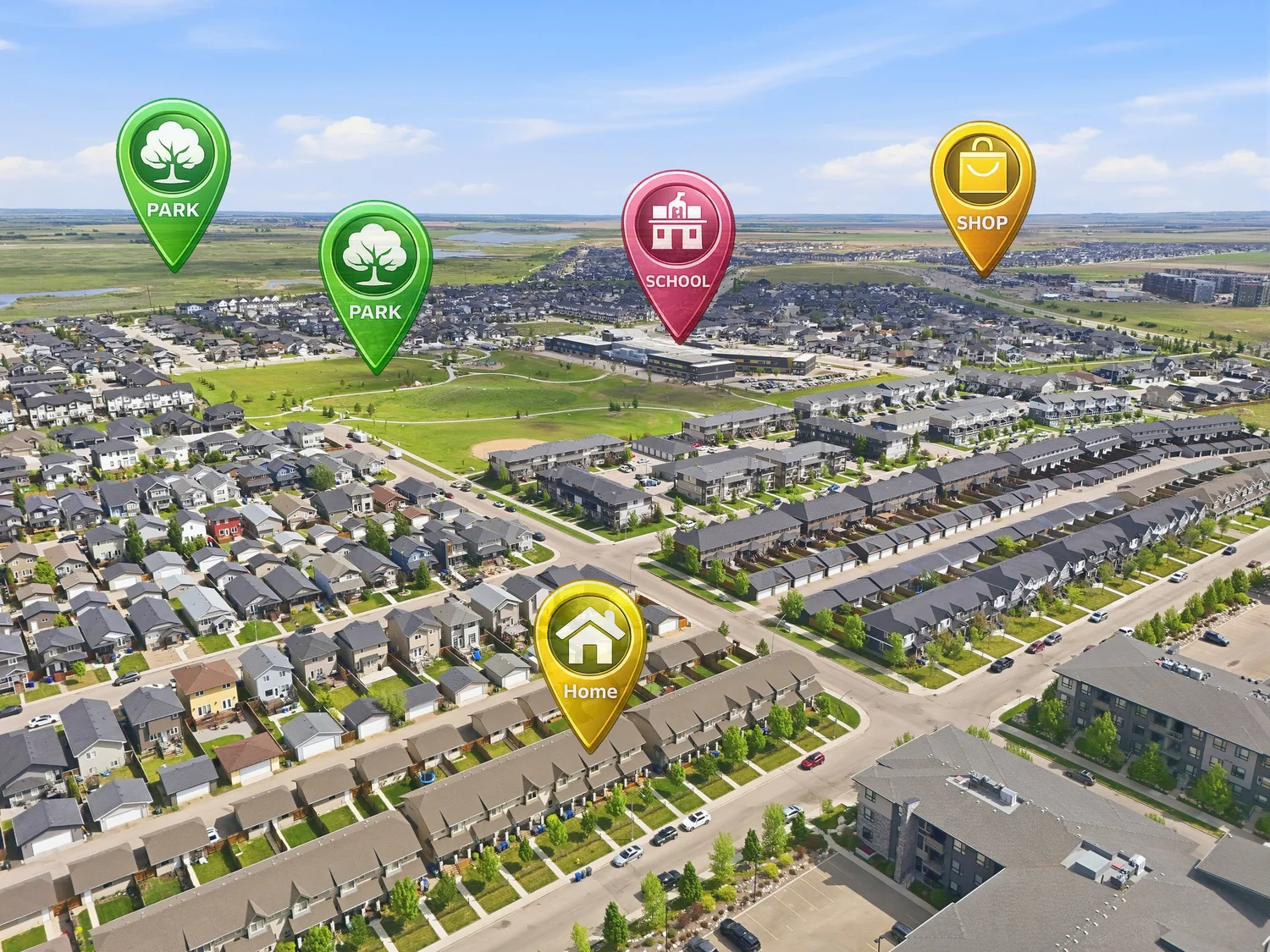
Every address is considered individually.
A clear sky does not automatically mean a flight can proceed, and a licence does not make every location or shot available.
Send the property address and time-sensitive requirements before booking when drone coverage is important.
Professional aerial work requires judgement at every property.
Scott is a Transport Canada–licensed drone pilot. Licensing supports a professional process, but responsible operation also depends on the conditions at each site.
Before and during a flight
- The address and surrounding airspace are considered
- Weather, wind and visibility are assessed
- People, buildings, traffic and nearby activity matter
- Launch, flight and landing conditions must be safe
- The requested coverage must have a useful purpose
Scott plans the coverage, operates the aircraft and stands behind the finished aerial media.
Clear answers before takeoff.
When is drone photography useful for a listing?
Use it when an elevated view helps explain the lot, access, roofline, outbuildings, outdoor features or surrounding context. It is not necessary for every property.
Can drone video be included?
Yes, when the selected service, location, weather, airspace and safe operating conditions allow. Confirm whether footage is intended for a horizontal film, vertical edit or another approved use.
Can you show property lines?
Approximate property-line overlays can be added for marketing context. They are not legal boundaries or surveys, and material boundary information should be independently verified.
Can you add pins or label nearby amenities?
Approved location markers and points of interest can be added when they help explain the property. Information should be verified and must not imply an unsupported relationship or distance.
What happens if conditions prevent the flight?
If weather, airspace, access or site conditions prevent safe and legal coverage, Scott explains the available options.
Do you fly outside Saskatoon?
Contact Scott with the property address before booking to confirm availability and any travel terms.
How quickly is aerial media delivered?
Media is delivered by noon the next day.
Show buyers what the ground-level view cannot.
Choose drone media when the elevated viewpoint helps buyers understand the property. Scott plans, captures and delivers the work directly—one experienced local provider accountable for the result.
Full-time since 2012 • 10,000+ properties photographed • PFRE Photographer of the Year 2024 • Transport Canada–licensed drone pilot
Practical questions and next steps
Reviewed October 7, 2026. Confirm your order’s services, timing and usage terms before booking or publishing.
When is drone photography worth adding to a listing?
Drone imagery is worth considering when an elevated view explains land, access, outbuildings, outdoor features or setting better than ground photographs. It is not needed simply because it is available. For a straightforward city lot, strong exterior images may be sufficient. Send the address and the buyer question you want the aerial view to answer before selecting coverage.
Does a city house need aerial photos?
A city house may benefit from aerial images if its lot shape, park setting, view or outdoor features are important. A typical home on a straightforward lot may already be clear from ground-level exteriors. Choose aerials for added information, and confirm feasibility at the address rather than assuming the selected shot is always possible.
When are drone photographs useful for a condo?
For a condo, aerials can explain the building’s setting, access or nearby open space. They do not replace photographs of the unit, its plan or permitted amenities. Avoid implying that an aerial view is the outlook from a particular suite. Confirm building access and any approved shared areas, then decide whether the wider context helps buyers.
What aerial views should an acreage listing include?
Useful acreage views connect the home to driveways, entrances, outbuildings, tree lines and surrounding land. Mix a clear overview with closer views that keep the structures readable. Identify important access routes and buildings before capture. Any property-line overlay is illustrative; verify boundary information independently and do not present marketing graphics as a survey.
Are property-line overlays legally accurate boundaries?
No. Property-line graphics on marketing photographs are approximate visual guides, not legal surveys. Provide reliable boundary information if an overlay is requested, identify the graphic as approximate and avoid implying greater precision than the source supports. Buyers needing an exact boundary should consult the appropriate survey or title information; confirm the annotation brief before editing.
Can a photographer fly a drone anywhere in Saskatoon?
No. Flight feasibility depends on the address, airspace, aircraft, operation, people nearby and conditions. A pilot certificate does not authorize every flight. Transport Canada’s operation categories distinguish requirements by the operation. Send the address and requested coverage in advance so Scott can assess what can be captured safely and legally.
What drone credentials should a Realtor ask to see?
Ask which aircraft and operation category apply, what pilot certificate or authorization is needed, and whether the planned flight is covered by appropriate insurance. Requirements vary; there is no single permission that makes every commercial address flyable. Check Transport Canada’s current categories, then ask the provider to confirm the credentials relevant to your specific shoot.
What happens when wind or weather prevents a drone flight?
Unsafe wind, weather or visibility can prevent aerial capture even when interior photography proceeds. Ask Scott which part of the order can be completed and whether another capture window or alternative view is practical. Return visits depend on conditions, access and scheduling; confirm any charges and revised delivery date before changing the listing launch.
Can drone imagery show nearby parks and amenities fairly?
Use verified landmarks and accurate labels to explain the setting. Do not suggest a park is part of the property, exaggerate proximity or disguise intervening roads and buildings. A wide view gives context but may not communicate walking distance. Check names and locations before approving an overlay, and use a map or stated verified distance when precision matters.
Does drone photography diagnose roof condition?
No. Marketing aerials can show rooflines and visible surfaces, but they are not a roof inspection or a diagnosis of hidden defects. Image angle, resolution and coverage may leave important areas unseen. Use the photographs to explain the property’s appearance, and arrange an appropriate inspection if condition or repair decisions depend on the roof.
Book the media for your listing · Explore customer resources