Property Line Overlays on Aerial Photos: Illustrative, Not a Survey
When a buyer sees a property-line overlay on an aerial photograph, it is easy to assume the line represents the exact legal boundary of the property.
It does not.
A property-line overlay added to a real estate photograph is an illustrative marketing graphic. It can help buyers understand how a home, yard, outbuildings, driveway or field relates to the surrounding land. However, it is only as reliable as the boundary information supplied for the graphic. It is not a survey, a legal determination of title, or a substitute for a real property report, surveyor’s certificate or registered plan.
That distinction matters for Realtors marketing properties in Saskatoon, Saskatchewan and Central Saskatchewan: particularly acreages, large rural parcels, corner lots and properties where fences, driveways or buildings do not clearly indicate the actual boundary.
What a property-line overlay can help explain
Ground-level photographs show the home and its immediate outdoor spaces. They generally cannot answer broader questions such as:
- How large or irregular is the lot?
- Where are the outbuildings positioned in relation to the home?
- Does the driveway appear to serve the property directly?
- How does the home sit within the larger acreage?
- Is a field, treed area or open space part of the property or simply adjacent to it?
- How close does a fence appear to be to the boundary?
- What portion of the land is visible from the home?
An aerial photograph can provide useful context. It shows the relationship between structures, access points, landscaping, neighbouring land and the broader setting in a way that ground photography cannot.
A restrained overlay may make that context easier to interpret. It can show buyers the general area being discussed without requiring them to infer the lot shape from fences, tree lines or other visual clues.
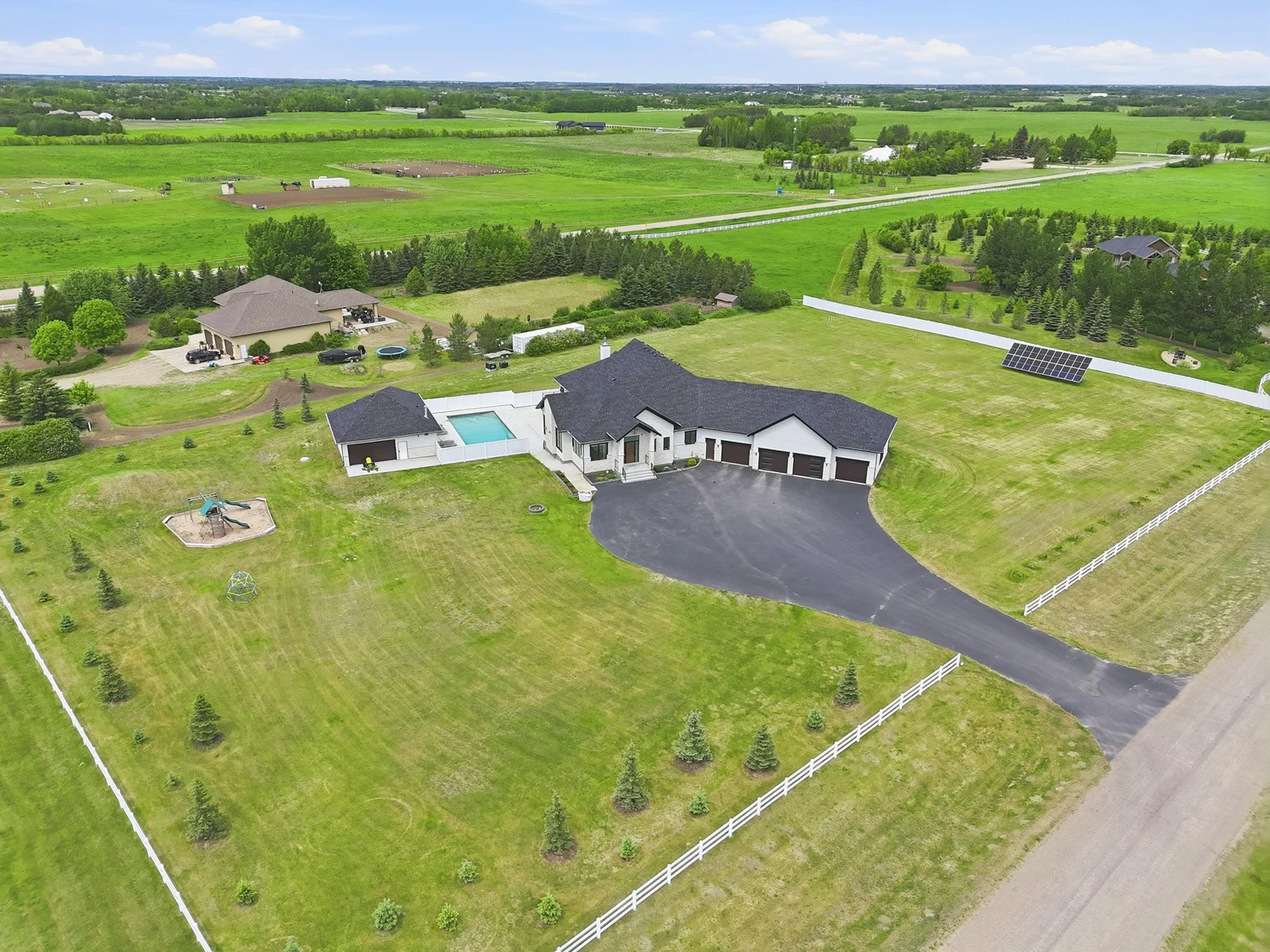
An aerial image can explain land, access and outbuilding relationships. It does not establish the legal parcel boundary.
What the overlay must be based on
A property-line overlay should never be estimated by drawing a line around the visible yard, fence or field in the drone photograph.
The photograph itself does not provide enough information to determine the legal boundary. Fences may not sit on the boundary. A driveway may cross or approach another parcel. Tree lines and cultivated areas may have no connection to the legal parcel. A neighbour’s land may look continuous with the property being marketed.
If an overlay is requested, it should be built from boundary information supplied by the owner or Realtor, such as:
- A registered plan
- A real property report
- A surveyor’s certificate
- Another reliable property document
- A sketch or plan that the owner or agent has reviewed and can vouch for
The source needs to be considered before any line is added. It should be clear what the document represents, whether it is current and whether it actually covers the portion of land being shown.
If the available information is uncertain, incomplete or disputed, the safer choice is to omit the overlay. An aerial photograph without a boundary graphic is more responsible than a confident-looking line that cannot be supported.
How the graphic should be labelled
The disclaimer should appear on the image itself, close to the overlay. It should not be hidden in a property website footer or left only to a caption that may be separated from the image when the graphic is shared.
A suitable label could read:
Illustrative property-line overlay only. Approximate, not surveyed and not a legal boundary. Do not rely on this image to determine property boundaries, dimensions, area, ownership or setbacks. Verify using the registered plan, a real property report or a qualified land surveyor.
The exact wording can be adjusted to suit the available space, but the meaning should remain clear.
The caption or surrounding listing copy should reinforce the same point. For example:
Approximate property-line overlay provided for marketing context only. This image is not a survey or legal determination of the property boundary. Buyers should verify boundary information independently.
The graphic should also use visual treatment that communicates approximation:
- A thin or dashed line rather than a heavy solid boundary
- A restrained colour that remains visible without dominating the photograph
- A clear label positioned beside the line
- No survey-style dimensions unless they have been independently confirmed
- No filled area that makes the outlined parcel look more authoritative than it is
The purpose is to help buyers orient themselves, not to make the image resemble a legal plan.
Where Realtors should be especially cautious
Acreages and rural properties
Acreage listings often benefit most from aerial photography because the residence may sit among fields, trees, shops, barns, pasture, approaches and other structures.
They are also among the properties where a misleading overlay can create the most confusion.
A rural property may include land that is not visually separated from neighbouring parcels. Fences may be old, incomplete or placed for livestock management rather than boundary definition. Buildings may sit near a line, and roads or approaches may not make ownership obvious from above.
For an acreage, use the aerial photograph to explain the property’s setting and the relationship between its visible features. Treat any boundary graphic as approximate unless the source information has been properly reviewed.
For more information about using aerials, outbuilding views and broader property context, see the acreage photography service.
Corner lots
Corner lots can appear larger or differently shaped from the air because two roads, lanes, boulevards and neighbouring parcels meet around them.
Aerial perspective can also make a side yard appear connected to a property when it may be a municipal strip, shared access area or neighbouring land. Avoid implying that every visible lawn, parking area or landscaped section belongs to the listed property.
If a corner lot’s shape or outdoor area is important to the marketing, confirm the source information before requesting an overlay and use conservative wording in the caption.
Unregistered, uncertain or disputed boundaries
If there is uncertainty about the location of a boundary, the overlay should not be used to resolve that uncertainty.
A marketing photograph cannot settle a disagreement between neighbours, determine whether a fence is correctly placed or establish ownership of an area that is not clearly documented. The same applies where the owner or agent has only an informal estimate and no supporting plan or report.
In these situations, discuss the issue with the seller and brokerage before publishing the image. If an exact boundary matters to a buyer’s decision, the appropriate source is the registered plan, a property report already held by the seller or advice from a qualified land surveyor, not the drone photograph.

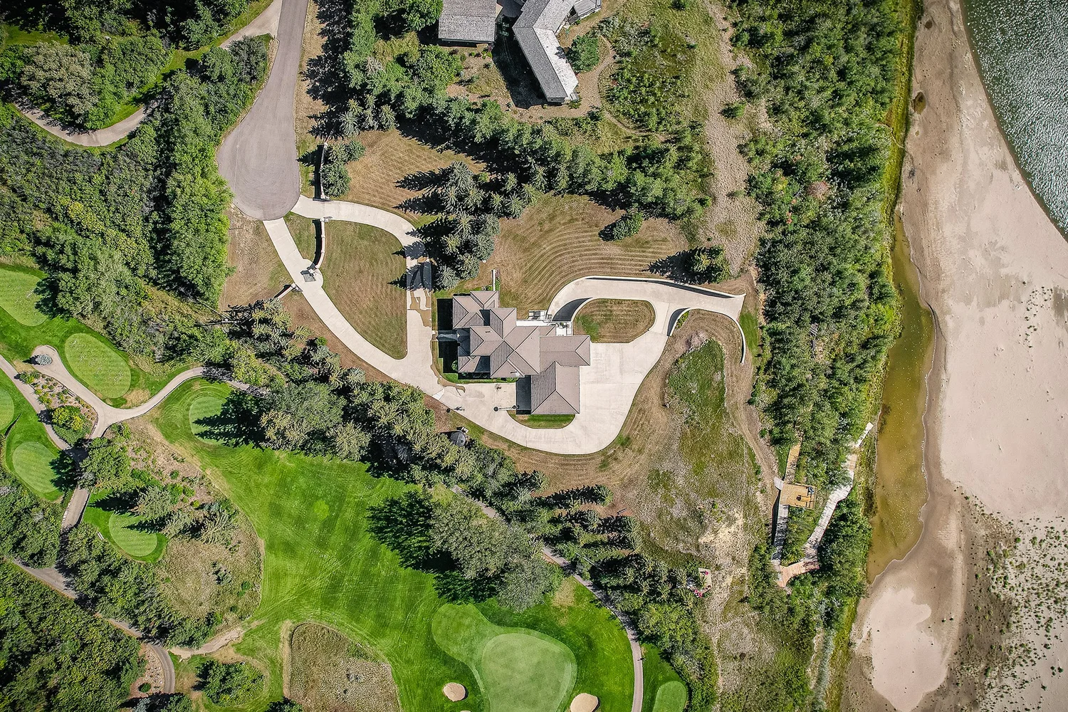
The wider view provides orientation and context, but visible landscaping and structures do not automatically define ownership.
What drone media can, and cannot, establish
Aerial photography can show:
- The visible relationship between a home and its surroundings
- Approximate location of driveways and access points
- The position of visible outbuildings
- The appearance of fields, trees, landscaping and open space
- The broader setting around a property
- How the home appears to sit within the land
It cannot, by itself, establish:
- The exact legal boundary
- Ownership of visible land
- Lot dimensions or acreage
- Easements or rights of way
- Setbacks from a boundary
- Encroachments
- Whether a fence is correctly positioned
- Whether a building is legally located on the parcel
- The outcome of a boundary dispute
This is true regardless of how high-resolution the image is or how carefully the line has been drawn. Adding a graphic to an aerial photograph does not turn the photograph into a survey.
The aerial drone photography page explains how drone media can show land, access, outbuildings and setting while keeping its purpose focused on property marketing.
What to do if a buyer treats the overlay as authoritative
If a buyer asks about a line in the image as though it confirms the legal boundary, correct the misunderstanding promptly.
A Realtor can say:
The line is an approximate marketing overlay, not a surveyed boundary. Please rely on the registered plan or other appropriate property documentation, and obtain independent advice from a qualified land surveyor if the exact boundary is important to your decision.
Do not repeat the line as fact in an email, feature sheet, social post or showing conversation. Do not add dimensions or make statements about ownership simply because the aerial graphic appears to support them.
If the buyer’s question reveals a material uncertainty (such as the location of a fence, a shop, an access route or a portion of the yard) raise it with the seller and brokerage. The overlay may need to be corrected, removed or replaced with more cautious wording across every channel where it has been published.
Consistency matters. An accurate disclaimer on the property website does not correct an unlabelled version shared on social media or included in a video frame.
A practical checklist before requesting an overlay
Before the image is edited, confirm:
- What specific buyer question is the overlay meant to answer?
- What document or source will the boundary line be based on?
- Has the owner or agent reviewed and approved that source?
- Is the information current and relevant to the land shown?
- Are there fences, buildings, roads or other features that could be mistaken for the boundary?
- Will the image label clearly state that the graphic is illustrative and not a survey?
- Will the same disclaimer appear in the caption and other marketing uses?
- Has the brokerage reviewed the graphic if the boundary information is material or uncertain?
If those questions cannot be answered confidently, the better marketing decision may be to use an unannotated aerial photograph and describe the property only through information that has been verified.
The right role for an aerial overlay
A property-line overlay can be a useful orientation tool. It can help a buyer understand the intended relationship between a home, its land and its visible features, especially for an acreage or an unusually shaped property.
Its value comes from making the marketing image easier to interpret, not from replacing property documentation.
Use the line conservatively. Base it on information the owner or Realtor can support. Label it prominently. Keep the caption accurate. And when an exact boundary matters, direct the buyer to the registered plan, a real property report or a qualified land surveyor.
If aerial media would help explain a Saskatoon or Central Saskatchewan listing, review the current pricing and package options or book a listing. Provide the property address and note whether land, access, outbuildings or a boundary illustration is part of the marketing brief.